As the Beaches Wash Away - Global Warming and Coastal Erosion
Last modified: 12th August 2019

- Sea Level Rise - Why the World is Not Like Your Bathtub
- Melting Glaciers and Isostatic Rebound
- Glacier Shrinking leads to Beach Erosion
- Beach Erosion leads to Glacier Shrinking
- Global Warming and the Future of Coastal Erosion
Related Content
- Life on Ice Journey - main page
- Melting by the Maps - an exploration of change and erosion near Fountain Stream from 1890 to 2011
- Glacier Retreat in Alaska
- Global Warming in Alaska - overview
- Adventures in a Warming Alaska Photos
- Coastal Erosion Photos
- Life on Ice Photos
Near the edge of the ice, a curtain of spruce roots trailed down a steep sand bluff. Their ends tangled with the greenish-brown piles of kelp at the top of the beach - forest abruptly meeting ocean. Fishing buoys and a dead skate, tossed up by the tide, littered the mossy forest floor at the ocean’s edge. Freshly broken trees, bright green and smelling strongly of spruce pitch, had toppled down onto the gravel beach below. I walked the edge of Malaspina Glacier on the Gulf of Alaska coast, watching global warming and the resulting erosion remake the world in front of my eyes.
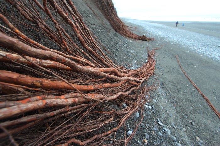
It was the second time in a week I’d stood on this shore, and in that short time a storm had reshaped it completely. Stream mouths were re-routed. Great piles of logs had washed away, accumulating on new stretches of shore. We hunted for antique glass balls exhumed by storm waves and strewn in drift lines with green twigs and uprooted tube-worms. In a few places, the ocean had scraped away the sand altogether, revealing soft mud that offered little resistance to the crashing waves.
A huge part of the globe’s population and infrastructure is found on coastlines. Global warming is quickly becoming a driving factor in the reshaping of these shores - through a combination of sea level rise and beach dynamics. In the fall of 2011, I spent two months on Alaska’s wild Lost Coast, experiencing the impacts of global warming at the edge one of North America’s largest glaciers, and exploring the implications for the rest of the world.
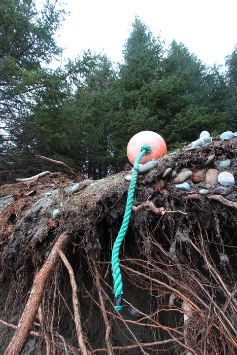
During the storm, sea foam pelted our tent as we rolled boulders into place, anchoring the thin nylon walls. The intensity of the gale kicked up our adrenaline, and whipped the surf up into what seemed like monstrous curls. But with winds of perhaps 50 miles per hour, it wasn’t a 100-year storm, or a 10-year storm. It might not even be a 1-year storm. This happens all the time. Every year, or every few years, the waves come crashing into the trees. Here, on the melting edge of Malaspina Glacier, the beaches are washing away.
In the middle of the wilderness, erosion harms little beyond the spruce trees. But around the world, shorelines are home to great metropolises and ports that move all the world’s goods. All are subject to the complicated dynamics that drive the formation and destruction of beaches, and vulnerable to changes in those forces. In most cases, global warming leads to increased erosion and endangers coastal communities.
Sea Level Rise - Why the World is Not Like Your Bathtub
Global Warming = Sea Level Rise. Exactly how much is hard to predict, but the 8 inches of sea level rise in the past century will be dwarfed by much greater rise in this century. Each news article pointing out the problem is accompanied by a map, coloring over coastal areas in blue, purporting to show what the world might look like if the ocean rose 3 feet, or 10 feet, or 20 feet.
Maps of sea level rise are often drawn as if the coast is a static shape in a static ocean, with water rising up the land like the filling of a bathtub. But a beach is more than just the place where the water meets the land. It’s a geologically active environment, constantly eroding and depositing sand and gravel. The shape of a beach is determined not just by water level, but by storms, currents, winds, and the nature of the sand and other sediment it is built from. These factors are affected by global warming and compounded by sea level rise. The erosion they cause can dwarf the impacts of simple inundation.
Melting Glaciers and Isostatic Rebound
In some ways, a rapidly melting glacier seems a poor place to look at coastal erosion. It’s actually one of the few places where you might expect global warming to cause the beaches to grow. Where melting glaciers are particularly large, there is a process that counteracts sea level rise called isostatic rebound.
Ice is heavy. Where there are big icefields and glaciers, it’s heavy enough to push the crust of the earth down with its weight. When the ice melts, the crust “rebounds”, bobbing up like a cork. When the land goes up, it looks the same on the beach as if the sea level has gone down. All else being equal, new beaches build below the older ones, and new forests spread out onto old beaches.
The Malaspina coast is rebounding. In other such places, like the coast around Glacier Bay, new beaches are advancing into the sea. But at Malaspina, erosion is winning. Climate warming brings a set of powerful forces that lead to erosion, counteracting even the impact of the rising land.
Glacier Shrinking leads to Beach Erosion
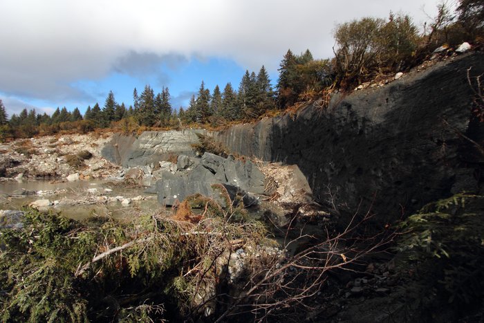
Melting Starves the Beach of Sand
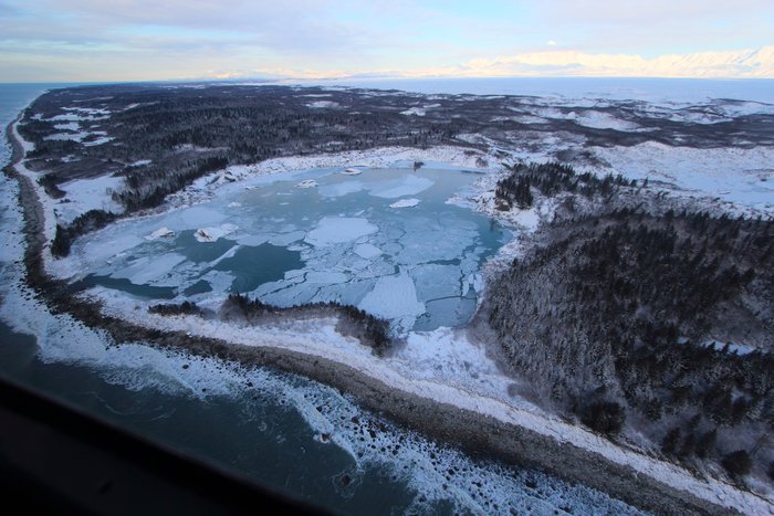
At the edge of Malaspina Glacier, gravel-covered icebergs calve into Malaspina Lake, Fountain Lake, and a host of other lakes with no recorded names. On the US Geological Survey topographic maps from 1979, many of these lakes don’t even exist. A few do not even appear on 4-year-old satellite photos. As glaciers shrink back, lakes often form at the former toe of the ice, separating the ice edge from the braided river downstream. We’ve seen it all over Alaska.
Glaciers flow down through the mountains, carving through rock, grinding it up into gravel, sand, and silt. These particles of rock are carried first by the glacier, then by the water flowing out of the ice. Sediment makes its way down the river to the ocean. But when a lake forms, it stops the sand and gravel. All the coarser sediment sinks to the bottom of the lake before it can reach the river, never making it down to the ocean. The water is still opaque with silt and clay. But silt and clay are too easily carried to settle on the beach. They flow straight into the ocean in a great grey-brown plume, doing nothing to hold the beach together against crashing ocean waves.
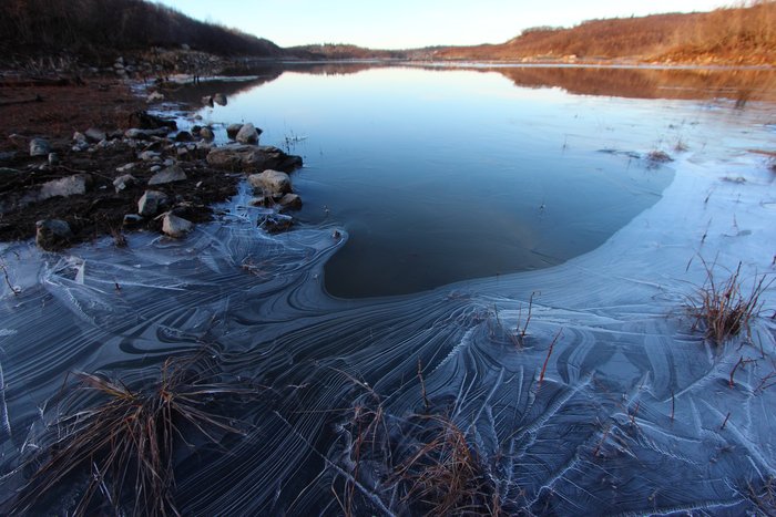
Sand and gravel are the food that keeps a beach alive. This sediment absorbs and dissipates the energy of the crashing waves, protecting the land behind it. But with each wave, a little bit of that sand and gravel gets carried offshore, never to return.
For a beach to remain in place, more sand and gravel must flow in from the rivers to replenish the beach. At Malaspina Glacier, much of that sand has stopped flowing, captured by new lakes along its front. All along the coastline, there are signs of dramatic erosion. The storm we watched eroded 10 feet of forest floor. Beneath the tree roots, we could see the remains of beaches formed only a few decades ago, when a surplus of sand was still flowing from the glacier.
Floods and Storms Carry the Sand Away
But the input of sand is only half the story. The erosion or building of a beach is determined not just by how much sand comes in, but how much is carried away.
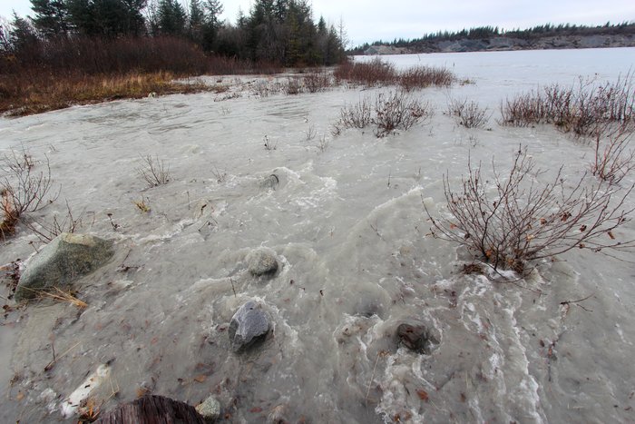
High on Malaspina Glacier, in a tent on the glowing blue ice, we watched an inch of ice melt away over the course of 24 hours - everywhere we hadn’t insulated with our gear. All that ice became water, gurgling into moulins, flowing through tunnels and channels in the ice, and swelling the rivers that pour from the glacier’s toe. One inch of ice lost across the 1000 square miles of the glacier. And that was just one fairly cool day. The coastal edge of the glacier is losing over 100 vertical inches of ice every year. The whole expanse of ice is losing at least 50 inches per year.
Rapid melting means more frequent and stronger flooding. The sand and gravel freed from that melting ice ends up in the bottom of ice edge lakes. The water pours out into the ocean.
Floodwaters are faster and stronger than regular river flow. Faster water carries more sand and gravel, and is far less likely to leave it on the beach. As a result, less sand ends up on the beaches, and more ends up offshore.

Warming air melts ice directly. And warming air also leads to larger, more energetic storms. Not only does the rain in these storms bring floods, but these storms bring stronger winds and bigger churning waves that stir up the sand that’s already on the beach. They prevent the sand from settling back down, and carry it offshore.
At Malaspina Glacier, global warming is starving the beach of sand. Sand is trapped in melt lakes at the edge of the ice, and sent offshore with meltwater floods and stronger storm waves. As a result, the beach is wasting away, and the coast behind it is eroding.
Beach Erosion leads to Glacier Shrinking
We watched as the tide poured water out of a small lagoon at the edge of the glacier. We watched as the surf crashed back in. We couldn’t tell which side was winning this tug of war, until finally, the dropping tide beat the surf, and a raft of logs began to stream out between the boulders. Some went out, and in, and out and in again, crashing and banging against the boulders, flipping vertically in the surf, finally escaping the clutches of the lagoon and barreling down the shore, crashing on beaches to the east.

In the aftermath of the storm, we saw whole boulders that had been moved, intertidal creatures suddenly out of place when their 5-ton home was tossed up the beach. This rocky shore doesn’t change shape as quickly as the sand and gravel beaches near it. But comparing our photos with those we took 4 years ago, we could see where giant boulders had been lost.
These boulders are all that separate the ocean from the ice at Sitkagi Lagoon. At every high tide, some seawater rushes in.
Seawater melts ice. Even in the cold North Pacific, the ocean is often 40 degrees in the winter and sometimes 50 degrees in the summer, much warmer than the 32 degree ice, and 32 degree water of a glacial lake. The more ocean water that hits the ice, the faster it melts.
The water rushing in is controlled by two factors: the size of the lagoon, and the size of the opening to the wider ocean. As the lagoon expands, it takes more water to fill it to the height of the tide, forcing more water and icebergs through the boulder barrier, and eroding the opening. And with the erosion of that boulder barrier, more and more seawater makes it in, melting the ice cliffs that line the lagoon, expanding the size of the lagoon.
The melting of the glacier is part of a feedback loop - a vicious cycle where melting leads to erosion that leads to melting again, accelerating both processes.
Global Warming and the Future of Coastal Erosion
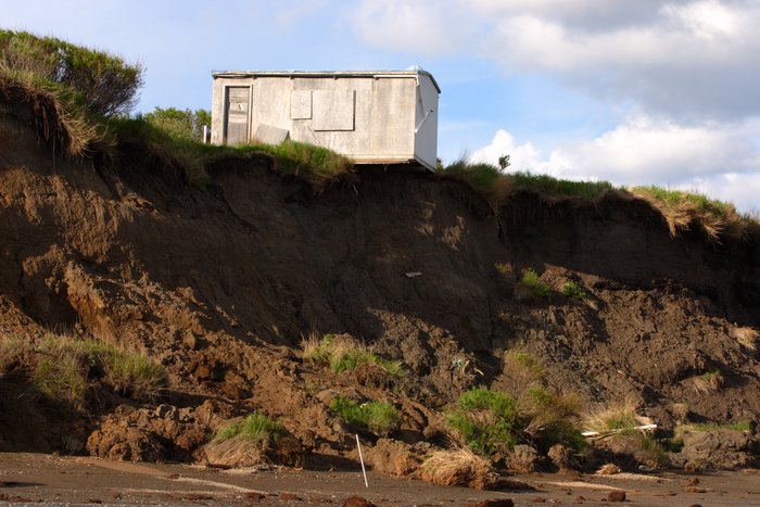
What does this mean for the rest of the world’s coasts? Storms are getting bigger everywhere. Those larger storms bring bigger waves, carrying sand offshore and eroding the coast. But the larger problem is sea level rise - combining with the forces of beach dynamics to produce a loss of shoreline far more dramatic than shown on a simple map of rising water level. At Malaspina Glacier, the dramatic erosion we saw is happening despite the land rising. And Malaspina is one of the few places in the world that can expect rising land to provide a buffer against rising sea level.
As sea level rises, it creates new space to tuck away sand. Similar to the effect of a small lake at the edge of the ice, the higher water level acts like a pool to trap sand.
When the sea rises, the forces of currents and waves will work to build new beaches, sand flats, and spits to replace the ones that have drowned - in equivalent positions, but higher up the shore. These features must be built out of new sand. And that new sand comes from erosion, higher up the beach and from the bases of seaside cliffs and bluffs. Once that sand is moved, the coastline that it once protected is newly vulnerable to even more dramatic erosion.
For those who are threatened by inundation, sea level rise is a particularly dramatic threat. But everyone along a coastline, even those who feel safely above any projected tide line, stands to lose through the forces of erosion.
The dramatic link between melting and erosion can be seen inthis series of maps and aerial photos of Fountain Stream from the 1890s to today. More images of coastal erosion are found in our Coastal Erosion Slideshow.
Created: Jan. 19, 2018