Background
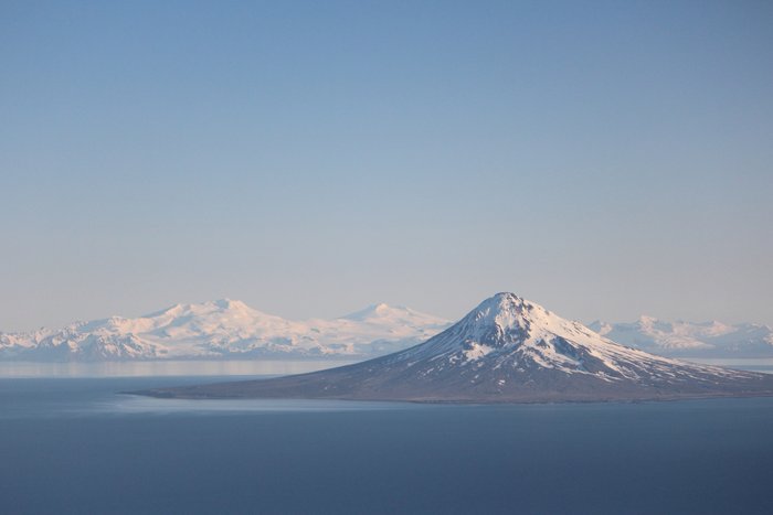
The state of Alaska will offer 65,992 acres of land on Augustine Island for geothermal exploration at an upcoming lease sale, probably in Spring 2013. In order to offer these leases, the Alaska DNR first conducted a “best interest finding” examining whether development of this resource was in the interest of the state. These analyses are required any time the state disposes of land or its interests in land, including leases for oil, gas, and coal development. After considering potential hazards, effects on subsistence in the area, and impacts on wildlife the department concluded that the sale should go forward.

Location and Project Details
The area encompassed by the leases covers all of Augustine Island, including tidelands and adjacent waters. All of the leases are on state owned lands. Augustine is the site of an active volcano, and is located near Kamishak Bay on the west side of Cook Inlet. The island is about 60 miles from Homer and 180 miles from Anchorage. The leases contain 65,992 acres, divided into 26 leasing tracts.
Potential Benefits and Concerns
Geothermal energy is an increasingly common renewable source of energy that doesn’t suffer the variations in output of wind and solar. Development of a resource on Augustine or Mt. Spurr would help Alaska meet its renewable energy targets. However, the viability of the resource on the island is totally unknown at this point. The two most often cited concerns are the distance from the island to the grid, and the presence of geologic hazards. Geologic hazards listed by the DNR include; volcanic ash clouds, ash fallout and volcanic bombs, pyroclastic flows, debris avalanches (as occurred on Augustine in 1883), tsunamis, earthquakes, directed blasts, lahars and floods, volcanic gases, and lava flow. The closest connection to the existing Railbelt grid is probably Nanwalek or Homer, about 50 miles away. However, if the Pebble prospect were developed this project would be only 15 miles away from Pebble’s potential energy grid (at the port site for the mine).
Current Status
Some of these leases were sold in May 2013 to a single bidder.
*[DNR]: Department of Natural Resources
Created: Jan. 19, 2018