≪ Prev.
Next ≫
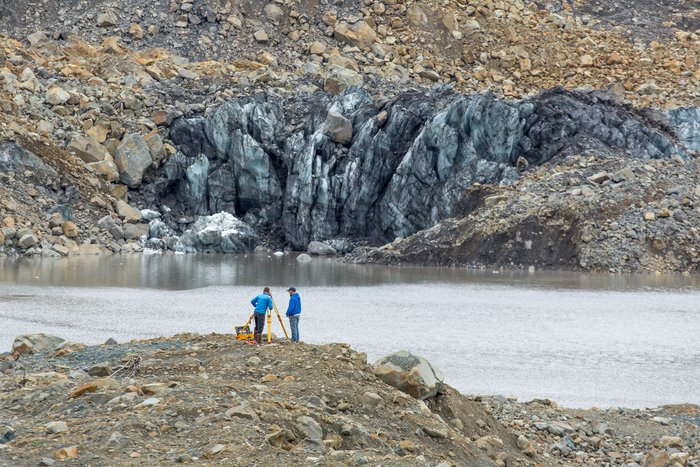
— The marine survey crew works from the Western shore of Taan Fjord, near the glacier snout, atop landslide debris. Over the course of a week, the marine survey team mapped several shallow-water locations but most importantly near Taan Glacier, where the landslide occurred.
Mapping Landslide Under Water
Get the one you need:
| File Size: | 22.4 KB | 84.9 KB | 130.9 KB | 509.0 KB | 999.0 KB |
| Image Size: | 300px | 600px | 750px | 1600px | Original |
Embed
1. Select a size:
2. Cut and Paste: