Tutka Backdoor information page
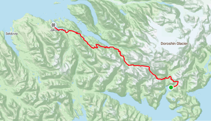
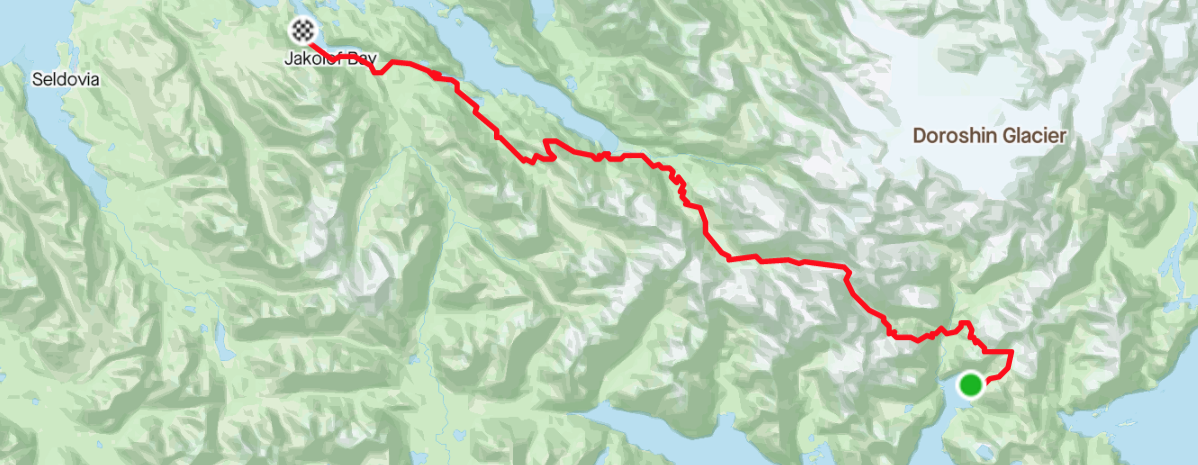
32 Miles of rugged backcountry trail from Taylor Bay on Gulf of Alaska to Jakolof Bay in Kachemak Bay, in Kachemak Bay State Park. This trail was built entirely by volunteers. Over 100 people put in over 1000 days of work to build this trail from 2016 to 2021. Future work will link the Jakolof Bay end of the trail with Red Mountain, Graduation Peak, and Seldovia, along easements and through state land.
For the latest trail reports and trip reports, check out the Facebook Page to see photos and hear about people’s experiences on the trail! Other resources include the GTT Kachemak Bay State Park map and the map Facebook Page.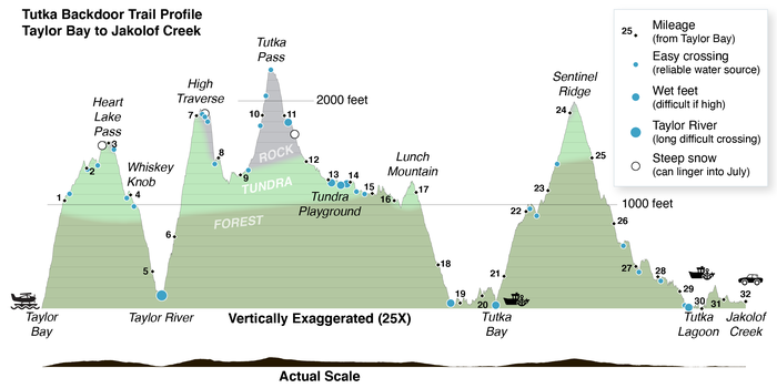
You can get to the trail by water taxi to the head of Tutka, take a floatplane to the far end in Taylor Bay, or even start hiking from Jakolof near Seldovia. If you want to buy a hiking map with a written trail-guide, there is one available here. There are several places you can start (see map)
The most common way to do the through hike is to start by floatplane in Taylor Bay, then hike to either the head of Tutka (for a shorter 20 mile option), or continue over Sentinel Ridge to Seastar cabin or Jakolof Bay (for a longer 30+ mile option).
As of summer 2022, the trail is in good shape and has been traversed by over a hundred and fifty people.
Trail
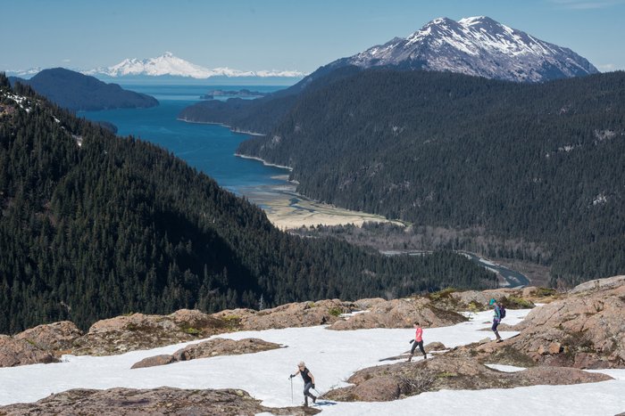
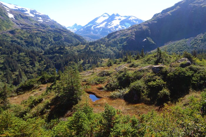
Once you’re on the trail, it is pretty straightforward to follow. This [profile] (/media/photos/2021/04/11/tutka-backdoor-profile-1600x1600.png) shows the course of the trail from Taylor Bay to Tutka. Using milages instead from Tutka, there are stream crossings at 0.6 and 2.5 miles from the trail start. In places the trail follows steep, narrow bear trails. At mile 7.2 and 7.9, there are two river fords - both are well placed at the best crossings, however rain can quickly raise the river, so approach with caution any time when it is or has been raining recently, or when there is a lot of snowmelt. Cairns or tread lead the way from there on the south side of the stream until a final crossing about a mile short of the pass. Beyond the pass, the trail is marked only with cairns for over a mile. At a constriction in the valley on the far side a few miles from the pass, cairns on the right (southwest) side of the river will mark the start of developed trail that goes another 8.7 miles to Taylor Bay. This part of the trail has 5300 feet of elevation change going up and down complex cliffy slopes. In it, there is a crossing of the Taylor River, which can be dangerous at high water - waiting for the water to lower, or packrafting across, may be required. On a sunny day, cross in the morning. On a rainy day, use your judgement – the water can rise quickly and may not be foot-crossable. Many of the steep traverses have tread, but some places require climbing sloping rock or traversing on slippery grass. Most of the time there will be patches of snow on the route until late July, and we recommend an ice axe. One area where this snow is particularly challenging comes at a traverse around 2.8 miles from Taylor Bay, where avalanche snow can leave the trail buried with steep icy snow past when most snow has melted.
Camping
Most of the trail is in the wilderness park where developed campsites are discouraged. The only developed campsite is at the head of Tutka Bay, 0.6 miles from the trail start. It serves as an alternate start point. Also, 5 miles from the trailhead there is a spur on the right that goes past a number of good camping areas - including a large open field at the end that has nearly unlimited space for camping, as well as rocky surfaces where building a fire won’t leave a scar. In general, try to spread out your impact - if you can see someone camped somewhere before, pick a new spot so the vegetation there can regrow. Only build fires on hard gravelly surfaces, and be especially careful not to build fires on tundra or in spruce forest duff. Be careful about going to the bathroom - carry out or deeply bury any toilet paper.
Because the trail travels many miles through alpine areas there are abundant options for camping - no need to follow the herd!
Packrafters
The lower mile of the Tutka River is packraftable - you can float from a nice gravel bar to the mouth of the river. However the river is more challenging (class II) than it appears in the places where you see it from the trail - there are fast sections and many sweepers, use caution and scout!
Packrafting is also an option in the tundra valley, where there’s about 2 miles of class II water interrupted by an un-runnable gorge with waterfalls.
The Taylor River is floatable for 1.1 miles down from the trail crossing toward Taylor Bay. The river then descends into a bouldery canyon that is probably unrunnable, but a steep bear trail provides a portage to below the rapid on river left. From there it’s a short float to the bay with one class II rapid. For a packrafter, this is a significant shortcut to the ocean, cutting off an entire climb and descent. Note the Taylor River can experience extreme flooding that completely changes the river.
Transport to and from the trail
There are three options for getting to the trail. Local water taxi and float plane operators are familiar with the trail, and should be able to answer any transportation questions.
- Take a boat to the head of Tutka, getting dropped off at one of the three places where the trail reaches the ocean.
- Take a boat to Jakolof dock, then follow 3 miles of road to the Tutka Lagoon trail, and hike from there to Tutka Lagoon, along the shore of the Lagoon, past the Tutka Hatchery, and up the Tutka Lakes trail to Sentinel Ridge and Tutka Backdoor. The shore of the lagoon is passable at a 13 foot tide or lower. The Tutka Lagoon Trail crosses Seldovia Native Association property. Please stay on the trail. This trailhead can also be reached by road from Seldovia.
- Fly to Taylor Bay by float plane, and hike back to one of the north trailheads. Nearly all through hikers do the hike this way because the weather is more often limiting on the south end, so delays would impact your start, rather than your finish.
Helping out and good stewardship
As with any wilderness camping - be careful not to leave trash: carry in what you carry out. Only build fires on gravel or rock surfaces (ideally active gravel bars along streams) at elevations below alpine tundra. If you bring a dog, make sure they are well-trained and will not chase wildlife such as marmots and mountain goats. Hiking off-trail is fine, but do your best to minimize impact, particularly in delicate alpine tundra. Avoid walking where the tundra appears worn, and preferably wear light flexible shoes that do less damage.
Also, the trail could use your help! If you want to join a work-party, email us at contact@groundtruthtrekking.org. Here are some things you can do any time:
- Drag cut branches away from the trail - there are a number of places where messy branches are near the trail. Drag these off out of sight. The only exception is places where the branches were used to cover bear trails - leave those in place.
- It’s very helpful to pull out salmonberry bushes near the trail. But don’t pull out small spruce trees in brushy areas - once these grow a bit they’ll help make the trail easier to maintain. Breaking or cutting salmonberries or other brush growing into the trail is helpful too - just leave overhead vegetation - the shade helps inhibit undergrowth. If you cut brush or branches, make sure not to leave stobs sticking out of the ground or trunks - all cuts should be flush with the trunk or ground.
- It’s also very helpful to just know how people are using the trail, and about what issues they run into. Drop us an email, or post on the Tutka Backdoor Facebook group. If you use a GPS, and are comfortable with someone else seeing that data, it would also be great if you could send your trackline to contact@groundtruthtrekking.org. We can analyze these tracklines to better understand how people are using the trail. We won’t share this data unless it is first anonymized.